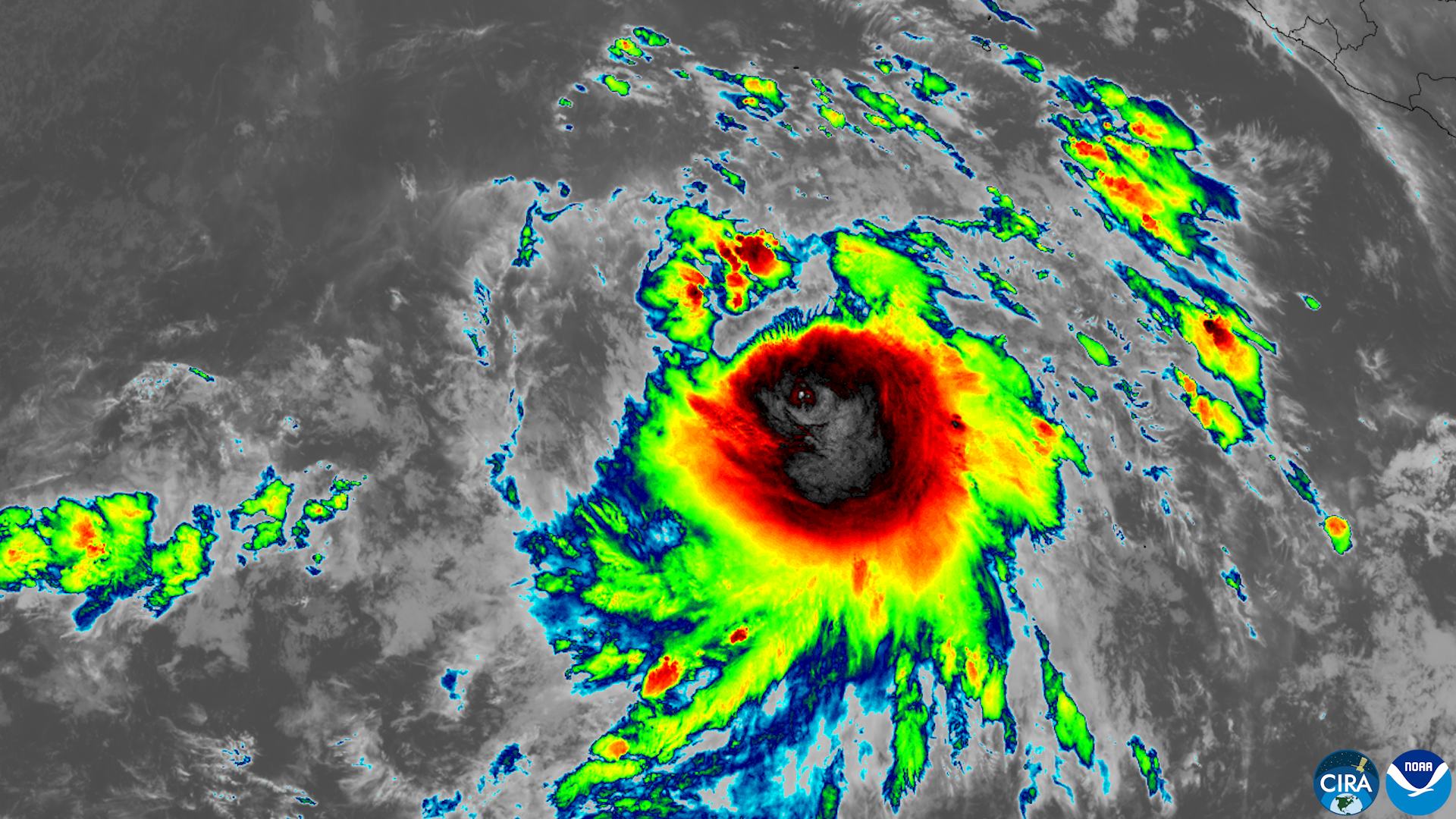
Hurricane Marie will stay hundreds of miles offshore, but Encinitas beachgoers face dangerous surf, strong rip currents and possible coastal flooding this Labor Day weekend.
The Category 1 hurricane, centered about 375 miles southwest of Baja California's southern tip as of Thursday, Sept. 3, is pushing a 6- to 8-foot south swell toward San Diego County beaches, according to the Los Angeles Times. The National Weather Service (NWS) said the biggest surf will hit from Oceanside northward, a zone that includes Moonlight State Beach and Swami's, the San Diego Union-Tribune reported.
The National Hurricane Center warned that Marie's swells will likely cause life-threatening surf and rip currents as they spread northward to Southern California over the weekend.
High surf advisories are likely for south-facing beaches from Sunday, Sept. 6, through Monday night, Sept. 7, the weather service said. Evening high tides are expected to reach 6.5 to 6.8 feet Sunday and about 7 feet Monday, raising the chance of moderate coastal flooding in low-lying areas and beach erosion, according to KPBS. If peak surf coincides with those tides, flooding and erosion could worsen.
A separate south-southwest swell from Hurricane Karina is also expected, adding to surf conditions. Surfline forecaster Kevin Wallis told the Union-Tribune that most of San Diego County will see 3- to 6-foot surf through the weekend from the combined swells.
Rain chances remain uncertain. The NWS estimated a 50% to 60% chance of light rainfall, 0.10 to 0.50 inches, from Sunday through Tuesday, Sept. 8, with a 10% to 15% chance of heavy rain and thunderstorms. But updated forecasts Thursday showed Marie shifting farther west, and KTLA meteorologist Henry DiCarlo said the move significantly reduced the likelihood of substantial rainfall.
"We'd encourage people if you are planning a beach trip to swim where there's a lifeguard and be aware of rip currents," NWS meteorologist Rose Schoenfeld told the LA Times. Coastal temperatures will be in the mid-80s over the weekend with humidity between 35% and 50%, Schoenfeld said.
Forecasters also flagged a 10% to 15% chance of moderate to strong easterly winds developing ahead of any rain, which could create fire-weather concerns.
The NWS San Diego office posted on X on Wednesday, Sept. 2, that Marie was likely to track far from the region but that rainfall amounts remained highly uncertain, ranging from completely dry to moderate. NWS meteorologist Sebastian Westerink of the San Diego office told the Orange County Register there is a 20% to 30% chance the storm turns northward, but even then it would not approach the impact of Tropical Storm Hilary.
If caught in a rip current, the NWS advises swimming parallel to the shoreline until the pull stops, then angling back toward shore. The agency warned beachgoers to stay off jetties, piers and rocks, and to never turn their backs on the ocean.
Encinitas Fire and Marine Safety had not issued a public advisory specific to Marie as of Thursday. Residents can check the latest conditions on the NWS San Diego forecast page.